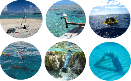
Rangiroa deployment -May 2025
In May 2025, a major instrumentation campaign has taken place on the Polynesian atoll of Rangiroa, northeast of Tahiti, as part of the FUTURISKS project and in collaboration with the LAGOON project. A total of 53 instruments have been deployed, including 34 pressure sensors, 2 barometers, 4 Spotter wave buoys, and 10 current meters. Additional measurements have been carried out with a GNSS buoy, a “nano-cyclopée” (acoustic altimeter + GNSS receiver), and a CTD in one of the world’s largest lagoons (~80 km long and 30 km wide).
Scientists have spent over two weeks on Rangiroa to prepare and install the instruments. This campaign was led by teams from Géosciences Montpellier, Ifremer, Shom, LIENSs, UPPA, and UBO. In parallel, researchers in geography have conducted surveys among the local population to assess perceptions of marine submersion risks.
Rangiroa retrieval
In August 2025, the first leg of the retrieval campaign was conducted on Rangiroa. 20 instruments were recovered, while 3 new ones were deployed to extend monitoring in the channels. A preliminary look at the data reveals 10 to 12 significant swell events recorded. An additional operation with the GNSS buoy and the “nano-cyclopée” was carried out at Rangiroa tide gauge location, allowing for inter-comparison of measurements to refine sea level dynamics analyses.
The second leg of the retrieval campaign is planned for November 2025.
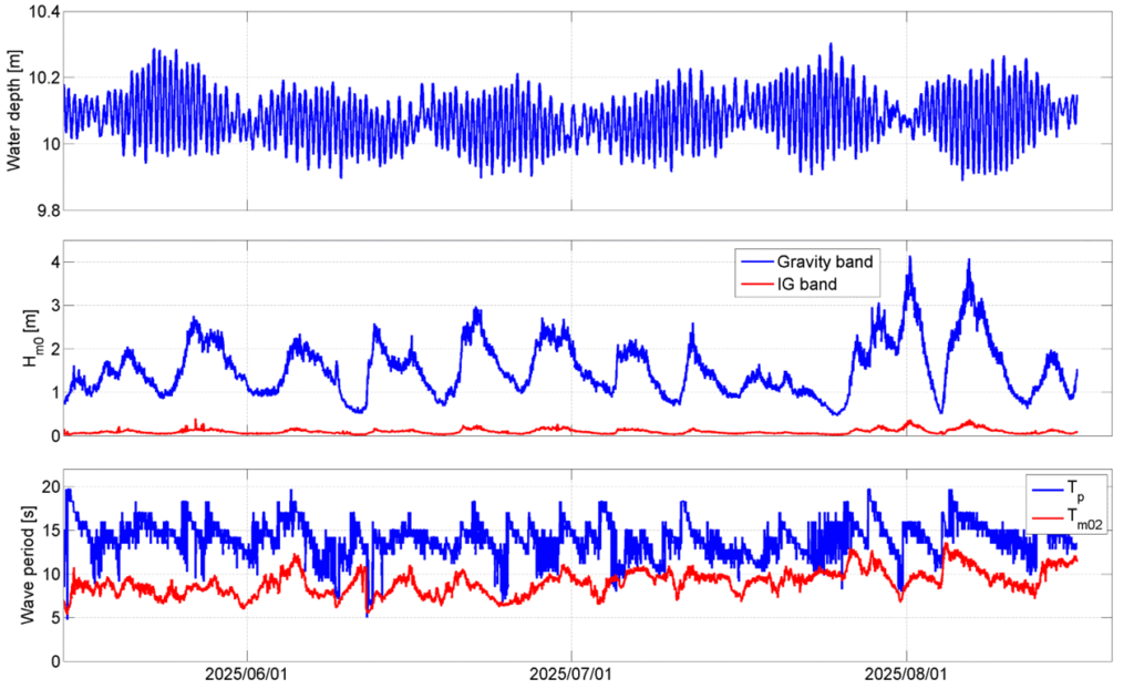
Variations of water depth (top), significant wave height (centre) and wave periods (bottom) at the pressure sensor located at the start of the densely instrumented profile to the south-west of Rangiroa atoll.