French polynesia
Rangiroa Atoll, Tuamotu Archipelago
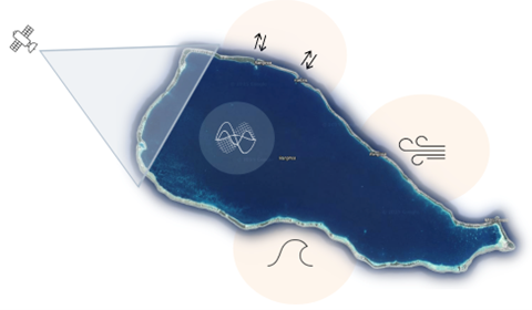
Rangiroa is one of the world’s largest atolls, located in the Tuamotu Archipelago of French Polynesia, northeast of Tahiti. It consists of a ring of low-lying coral islets surrounding a vast shallow lagoon. It extends 80 km in length and 32 km in width, with a lagoon of 1,446 km² and a maximum depth of just 35 m. The atoll is made up of around 240 motu separated by more than 100 narrow channels, with a total land area of 79 km² distributed across over 400 islets. Its lagoon, connected to the ocean through the Tiputa and Avatoru passes, can generate short waves and surges during periods of rough seas. Nine islands are permanently inhabited, while most remain natural or sparsely used. The population is approximately 3,000. With elevations of only a few meters above sea level, Rangiroa is highly exposed to marine flooding and sea-level rise. Cyclones are uncommon, yet events such as Orama-Nisha (1983) produced waves up to 9 m and surges of nearly 2 m on the southern reef. The hydrodynamics of the atoll are complex: low tidal ranges combine with three main wave regimes—strong SW swells and S–SE waves during austral autumn–winter, and a mixed regime of weaker N–NW and S–SW waves more frequent in summer. Some of these wave regimes can generate long waves within the lagoon, affecting setup. In addition, trade winds and episodic winds such as the Mara’amu create short waves inside the lagoon, making the causes of marine flooding multiple and interconnected.
Logos from Noun Project created by Adrien Coquet (arrows), Alviany (satellite), artworkbean (surface wave), Joey Hiller (waves), Esya Am (wind).
Anaa Atoll, Tuamotu Archipelago
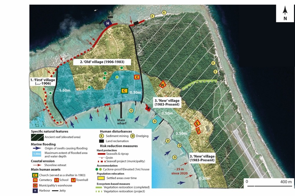
Anaa Atoll is small and it has no pass. It has a population of nearly 500 and is part of the same municipality as Faaite. Anaa is of major interest to the FUTURISKS project, firstly because it was devastated by two powerful cyclones in 1906 and 1983, which destroyed the village of Tukuhora and led to two successive relocations on the same island, and secondly because local stakeholders are combining various coastal adaptation measures (relocation to a relatively high ancient reef area, raised cyclone-resistant housing, hard engineering, and nature-based solutions).
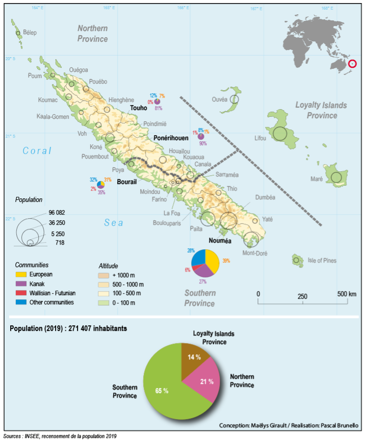
New Caledonia
Several interdisciplinary case studies are being conducted in New Caledonia:
– In the Southern Province, Grande Terre, work is being carried out in the Greater Nouméa (2/3 of the population) and in the municipality of Bourail (La Roche Percée, Poé). This mainly consists of assessing current and future coastal risks and the coastal adaptation measures that have been put in place.
– In the Northern Province, Grande Terre, several research teams are working in the municipalities of Touho, Ponérihouen, and Poindimié. Current and future coastal risks and coastal adaptation measures already in place are being assessed, and a local adaptation plan is being co-developed (Touho).
– In the Loyalty Islands Province, the site of Ouvéa was chosen due to the high level of concern among the population and local stakeholders about coastal erosion. Erosion has been quantified over 67 years and will be projected into the future, and the effectiveness of various adaptation measures on shoreline stabilization will be evaluated in order to support local adaptation.
Ouvea Atoll, Loyalty Islands
Located on the Loyalty Ridge, 100 km away from the main island of New Caledonia and bordered to the northeast by the Vanuatu subduction zone, Ouvéa is formed from a raised atoll. Due to tectonic activity, a tilt along the east-west axis contributed to the uplift on the eastern edge of the ancient reef crown built during the Pliocene to Pleistocene period, forming a remarkable ridge reaching a height of 40 meters. To the west, this tilt caused the ancient lagoon and its reef crown to disappear under the water, with the Southern and Northern Pleiades marking their location. Ouvéa covers an area of 132 km², 60% of which is below 10 m above sea level. Its coastal formations consist of sandbars and partially drained marshes, relics of ancient lagoons and channels. The open lagoons of Lékiny (Fassi) in the south and Saint-Joseph (Hnyimëk) in the north, the latter of which is in decline, bear witness to the stages of evolution of these systems. The South-West Pacific basin, which is conducive to cyclogenesis, contributes to the formation of frequent tropical depressions that sometimes develop into cyclones. Extreme conditions can contribute to the catastrophic flooding of former marshes, as was the case during the cyclone of 1951. The high concentration of activities and buildings at the top and behind the coastal dune, a legacy of customary organisation, Polynesian migrations and more recent colonial and missionary history, increases the vulnerability of inhabitants to the risk of marine submersion.